|
GNSS (GPS) PRECISION AND SYSTEM TIMING Exaggerated Animation (from BT Controller Status & Signal GUI) for Illustration ONLY 
PDOP (Position Dilution Of Precision): 

1 PPS Pulse from GPS Module
Can Be Precise to Billionths of a Second (ns) 
| |
Check Controller GPS Satellites tracked against those visible at your location Live at In-The-Sky.org | |
|
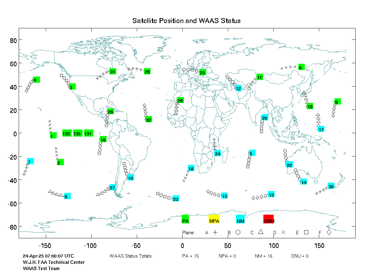
'Real Time' Global GPS Satellite Position and Status 3 min UpDate ± 1 min Delay | |
| SBAS Satellites (Geostationary) numbered 120 to 151 Blitzortung GUI may display SBAS using NMEA IDs, 33-64. (Add 87) ie. "44" = "131" In November 2018 the FCC issued waiver for certain US technology to utilize EU Galileo GNSS, but older BT systems may lack capable modules. | |
|
| |
|
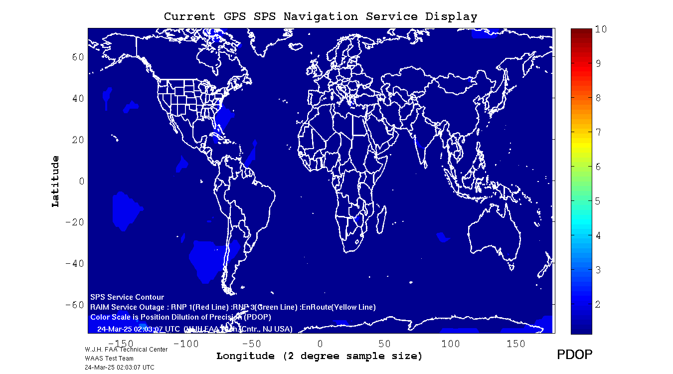
'Real Time' Global GPS PDOP 3 min UpDate ± 1 min Delay | |
|
| |
| 'Real Time' North America Geomagnetic — Ionospheric Influence and Compensations | |
Latest Available Img ±10 min UpDate GloTEC server lags real-time ±20 min
GNSS data can be affected by extreme GeoMagnetic Activity Background Info 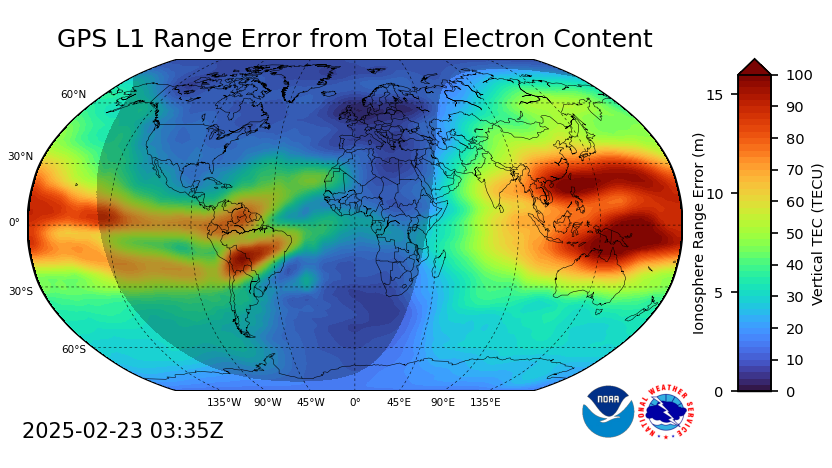
OLD NOAA Page: GPS Dashboard at NOAA SWPC
|
3 min UpDate ± 1 min Delay — CLICK GRAPHIC for full size image
WAAS corrections applied to GPS Timing NORTH AMERICA
"GIVE"
= Vertical Error
"DELAY"
= Position Error 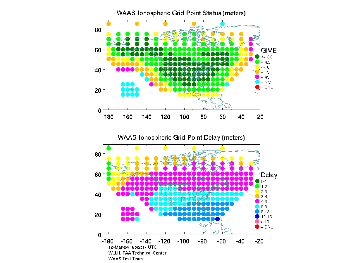
SBAS enabled attempts some corrections if SBAS satelite in view. |